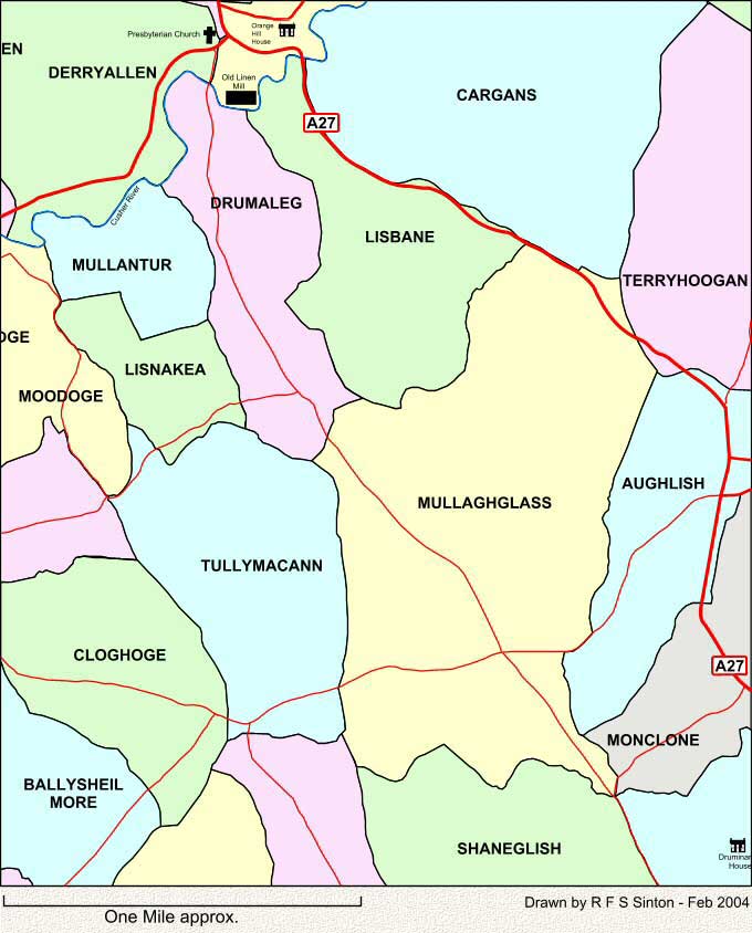

| MAP 22
This map shows the townlands to the south of Tandragee, Co. Armagh. The old linen mill at the top of the map was the last working mill of Thomas Sinton of Laurelvale. It stopped production in 1939. These maps are intended SOLELY for the non-commercial use of family history research. |

| 22 |
| Back | Map Index | Home |
|
This site is completely FREE but it does need money for upkeep. If you would like to contribute then please click on the Donate button. Thank you for your support. |
| E-mail Sinton Family Trees |